
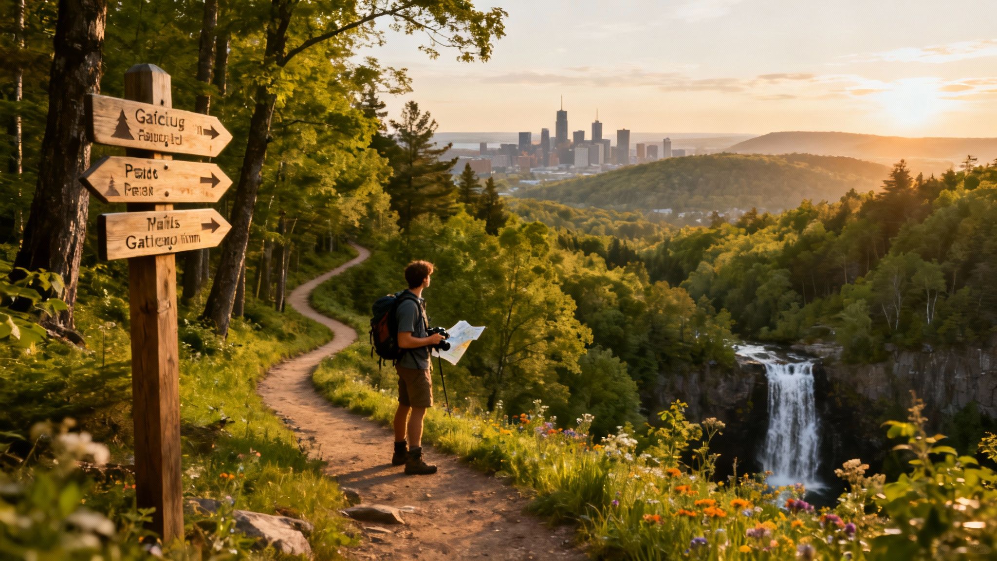
The National Capital Region, a unique intersection of urban life and natural preservation, offers an incredible variety of landscapes for every type of hiker. Whether you are seeking a quiet forest escape within city limits, a challenging climb with panoramic views across the Ottawa Valley, or a family-friendly stroll through a rare ecosystem, the area surrounding Ottawa delivers. This guide curates 10 of the best hiking trails near Ottawa, providing the practical information needed to plan your next outing.
We have compiled everything you need in one place. For each trail, you will find details such as distance from the city centre, trail length and difficulty, and estimated completion times. We also include specific highlights like lookouts, waterfalls, and unique flora, alongside logistical information covering parking and accessibility.
This list is designed to be a definitive resource for exploring the natural beauty on our doorstep. From the rugged Canadian Shield escarpments of Gatineau Park to the serene wetlands of the Mer Bleue Bog, this guide provides actionable insights to help you get outside. Our goal is to help you discover your next favourite path and make the most of what our region offers, no matter the season. Let's start exploring.
1. Rideau Falls Trail
For those seeking a great trail near Ottawa without leaving the city, the Rideau Falls Trail offers a spectacular and accessible urban escape. This short, paved pathway provides dramatic, up-close views of the twin Rideau Falls, where the Rideau River cascades into the Ottawa River. It's less of a traditional hike and more of a scenic walk, perfect for a quick dose of nature.
The trail’s biggest draw is its blend of natural power and urban convenience. It offers a front-row seat to the impressive waterfalls, the heritage buildings of Global Affairs Canada, and the French Embassy. Its placement makes it a vital link in Ottawa's Capital Pathway network, connecting easily to routes along both the Ottawa and Rideau Rivers.
Trail Details & Logistics
- Distance from Downtown Ottawa: 0 km (Located in the city)
- Trail Length: Approximately 1 km out-and-back
- Difficulty: Easy. The trail is paved and relatively flat.
- Estimated Time: 20-30 minutes
- Highlights: The twin Rideau Falls, views of the Ottawa River, historic architecture, interpretive panels explaining local history.
- Parking & Transit: Limited free parking is available in the lot at 50 Sussex Drive. The area is also accessible via several OC Transpo bus routes.
- Map: View Trail on Google Maps
Know Before You Go
This trail is ideal for families, individuals with mobility challenges, and anyone looking for stunning scenery without a long trek. Given its popularity, visiting on a weekday is best to avoid crowds. For the most impressive view of the falls, plan your visit during the spring melt when water flow is at its peak.
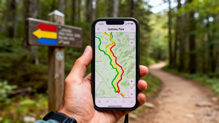
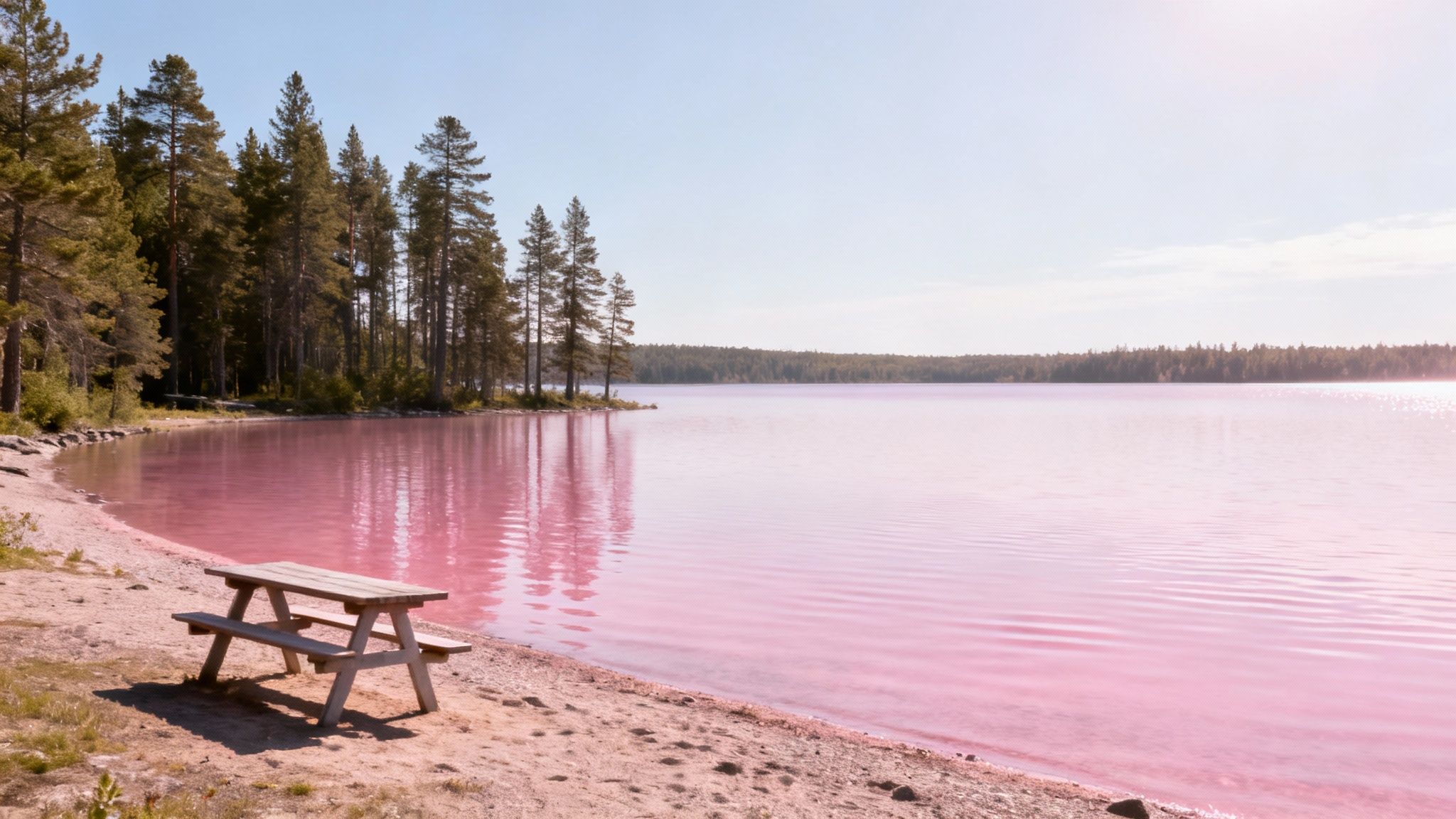
2. Gatineau Park – Pink Lake Trail
Just a short drive across the river into Quebec, the Pink Lake Trail in Gatineau Park is one of the best hiking trails near Ottawa for its captivating beauty. This trail loops around Pink Lake, a rare meromictic lake, meaning its layers of water do not mix. Despite its name, the lake’s mesmerizing turquoise-green colour is due to microscopic algae, offering a spectacular sight against the Canadian Shield landscape.
The trail is a well-maintained loop with boardwalks and stairs that navigate hilly terrain, providing hikers with multiple lookouts to admire the water below. Its combination of a moderate physical challenge, ecological significance, and breathtaking scenery makes it an essential experience for any local or visiting outdoor enthusiast.
Trail Details & Logistics
- Distance from Downtown Ottawa: Approximately 16 km
- Trail Length: 2.3 km loop
- Difficulty: Moderate. The trail includes many stairs and some steep sections.
- Estimated Time: 45-60 minutes
- Highlights: The brilliant turquoise-green meromictic lake, scenic lookouts, interpretive panels on the area's unique ecology, and the ruins of a mica mine.
- Parking & Transit: A paid parking lot (P5) is available at the trailhead. This is a very popular spot, so arriving early is recommended. The park is not easily accessible via public transit from Ottawa.
- Map: View Trail on Google Maps
Know Before You Go
This trail is a fantastic choice for a rewarding workout with exceptional views. However, the stairs make it unsuitable for strollers. Swimming is strictly prohibited to protect the lake's delicate ecosystem. To see the water at its most vibrant, visit on a sunny day. The trail is busiest on weekends, so consider a weekday trip.
3. Meech Lake Loop Trail
For hikers seeking a more challenging Gatineau Park experience, the Meech Lake Loop Trail offers pristine forest scenery and lakeside views. This trail encircles Meech Lake, providing a rewarding intermediate-level hike that feels a world away from the city. It’s a significant step up from shorter park trails, delivering greater solitude.
The trail's appeal lies in its diverse terrain, which winds through dense woodlands, over rolling hills, and along the shoreline. Unlike more crowded spots, this loop offers a quieter connection to nature, with opportunities to stop at several sandy beaches like O'Brien Beach and Blanchet Beach. This makes it a great choice for those who want a full-day adventure combining vigorous hiking with relaxing breaks.
Trail Details & Logistics
- Distance from Downtown Ottawa: Approximately 25 km
- Trail Length: Roughly 20 km loop (unofficial trail network)
- Difficulty: Intermediate. The trail has significant elevation changes and rugged sections.
- Estimated Time: 5-7 hours
- Highlights: Panoramic views of Meech Lake, sandy beaches for swimming, mature forests, the historic Mackenzie King Estate nearby.
- Parking & Transit: Parking is available at P11 (O'Brien Beach) or P12 (Blanchet Beach). Lots fill up quickly on weekends, so an early start is crucial. There is no direct public transit.
- Map: View Trail on AllTrails
Know Before You Go
This is not an officially marked NCC trail, so navigation skills and a map are essential. Good hiking boots are a must due to the rocky terrain. Pack plenty of water and snacks, as there are no services along the loop. The trail is particularly stunning in the autumn when the fall colours reflect on the lake's surface.
4. Greenbelt Trail – Mer Bleue Bog Section
For a unique outdoor experience, the Mer Bleue Bog section of the Greenbelt Trail is one of the most interesting hikes near Ottawa. This trail transports you into a 7,700-year-old boreal ecosystem, a landscape typically found hundreds of kilometres north. Its centrepiece is a 1.9 km interpretive boardwalk that floats over the bog, offering an intimate look at a fragile environment.
The trail’s appeal is its biodiversity and its role as an internationally recognized wetland. As you walk the boardwalk, you'll see carnivorous pitcher plants, sundew, and wild cranberry. This living outdoor museum provides a fascinating lesson in ecology, making it a perfect destination for curious hikers, families, and nature photographers.
Trail Details & Logistics
- Distance from Downtown Ottawa: Approximately 20 km
- Trail Length: 1.9 km interpretive boardwalk loop, with longer trails (up to 20 km) available in the surrounding area.
- Difficulty: Easy. The boardwalk is flat and accessible.
- Estimated Time: 30-45 minutes for the main boardwalk loop.
- Highlights: The rare boreal bog ecosystem, interpretive panels, carnivorous plants, excellent birdwatching, stunning fall colours.
- Parking & Transit: Free parking is available at the P22 parking lot off Ridge Road. The area is not easily accessible via public transit.
- Map: View Trail on Google Maps
Know Before You Go
Mer Bleue Bog is famous for its insect population, especially in early summer, so bringing insect repellent is essential. The boardwalk can become slippery when wet. For the best experience, visit in the early morning for peaceful birdwatching or in the autumn when the shrubs turn brilliant shades of red and orange.
5. Stony Swamp Trail
For a genuine wilderness experience not far from the city's west end, the Stony Swamp Trail system is an excellent choice. As the largest forested area within the National Capital Greenbelt, this conservation area presents a mosaic of wetlands, beaver ponds, and mature forests. It is an ecological treasure, offering a more rustic and immersive nature escape.
The primary appeal of Stony Swamp is its biodiversity. The network of trails, including the popular Beaver and Chipmunk trails, guides hikers through diverse habitats. It is renowned among local birdwatchers, especially during spring migration, and provides opportunities to spot beavers, deer, and other wildlife.
Trail Details & Logistics
- Distance from Downtown Ottawa: Approximately 15-20 km (west end)
- Trail Length: Over 40 km of interconnected trails (individual loops range from 1-4 km)
- Difficulty: Easy to Moderate. Trails are mostly flat but can be muddy or root-covered.
- Estimated Time: 30 minutes to several hours, depending on the route.
- Highlights: Exceptional wildlife and birdwatching, beaver ponds, diverse forest ecosystems, interpretive panels, and boardwalk sections.
- Parking & Transit: Multiple free parking lots are available, including P5 on Moodie Drive and P7 on Richmond Road. Limited OC Transpo service is nearby.
- Map: View Trails on NCC Website
Know Before You Go
To maximize wildlife sightings, visit early in the morning. The wetlands make this area a prime habitat for insects, so bringing repellent is essential. Due to the swampy terrain, waterproof boots are highly recommended. As the trail network is extensive, carrying a map is advisable.
6. Pink Mountain Trail – Gatineau Park
For hikers seeking a physical challenge with a spectacular payoff, the Pink Mountain Trail in Gatineau Park stands out. This route is known for offering one of the highest elevation gains in the region, making it a favourite for trekkers looking for a strenuous workout. The demanding ascent culminates in a panoramic vista that is one of the most rewarding in the park.
The trail’s appeal lies in its rugged character and the breathtaking views from the summit. On a clear day, the lookout provides expansive sightlines over the Gatineau Hills and the Ottawa Valley. This trail is less about a casual stroll and more about a purposeful hike, attracting those who appreciate the physical exertion required to earn an unforgettable view.
Trail Details & Logistics
- Distance from Downtown Ottawa: Approximately 30 km
- Trail Length: 5.4 km loop
- Difficulty: Moderate to Difficult. The trail features sustained steep sections.
- Estimated Time: 2-3 hours
- Highlights: Panoramic summit lookout, significant elevation gain, rich forest biodiversity, a challenging physical workout.
- Parking & Transit: Parking is available at the Pink Lake Lookout parking lot (P5). This is a very popular spot, so arrive early. The area is not easily accessible by public transit.
- Map: View Trail on NCC Website
Know Before You Go
Proper preparation is key for this trail. Sturdy hiking boots are recommended. There are no water sources along the route, so be sure to bring plenty with you. The trail is best experienced on clear days to fully appreciate the views. To avoid crowds, start your hike early in the morning.
7. Kingsmere Lake Trail
For a Gatineau Park experience that blends a peaceful forest trek with a stunning lakeside destination, the Kingsmere Lake Trail is a standout choice. This intermediate trail guides hikers through a lush, mature forest, culminating at the shores of Kingsmere Lake. It strikes a perfect balance, offering a rewarding physical challenge without being overly strenuous.
The trail’s main appeal is the destination: a beautiful, clear lake that invites hikers to swim, picnic, or relax on its shores. The journey is equally captivating, with rolling terrain and towering trees providing a tranquil escape. It’s an ideal trail for those looking to immerse themselves in the natural beauty of the Canadian Shield landscape.
Trail Details & Logistics
- Distance from Downtown Ottawa: Approximately 25 km
- Trail Length: 2.5 km loop (Trail 30 from P7)
- Difficulty: Intermediate. The trail features some hills and uneven terrain.
- Estimated Time: 1-1.5 hours
- Highlights: Kingsmere Lake access for swimming and picnics, beautiful forest scenery, the historic Mackenzie King Estate nearby.
- Parking & Transit: Parking is available at the P7 parking lot off Kingsmere Road. This lot can fill up quickly. No direct public transit is available.
- Map: View Trail on Google Maps
Know Before You Go
This trail is a fantastic option for a warm summer day, so consider packing swimwear. To enjoy a more solitary experience, plan your visit for a weekday or arrive early on weekends. The lake’s shore is an excellent spot for a picnic. The trailhead is also close to the Mackenzie King Estate, allowing you to combine your hike with a visit to the historic grounds.
8. Dunrobin Conservation Area – Wolf Trail
For those searching for a serene woodland experience away from the crowds, the Wolf Trail at Dunrobin Conservation Area is a solid choice. Located west of the city, this hidden gem offers a peaceful retreat into a diverse forest. The trail provides a quiet alternative to the major parks, making it perfect for reflective walks and wildlife observation.
The primary appeal of the Wolf Trail is its authentic and undisturbed natural setting. Hikers will navigate through mixed forests, cross small creeks, and traverse varied terrain. Its relatively low traffic means you have a better chance of spotting local wildlife, including deer and birds, making it a rewarding destination.
Trail Details & Logistics
- Distance from Downtown Ottawa: Approximately 35 km
- Trail Length: 2.5 km loop
- Difficulty: Easy to Moderate. The trail is unpaved with gentle hills and small creek crossings.
- Estimated Time: 45-60 minutes
- Highlights: Quiet woodland setting, diverse forest types, small creek crossings, excellent opportunities for birdwatching and wildlife spotting.
- Parking & Transit: A small, free parking lot is available at the trailhead off Dunrobin Road. This area is not serviced by public transit.
- Map: View Trail on Google Maps
Know Before You Go
This trail is ideal for hikers seeking solitude. Remember to bring sturdy, waterproof footwear, as you will need to cross a few small streams. There are no facilities on-site, so pack in everything you need and be prepared to pack out all your garbage. Visiting in the early morning provides the best chance to see wildlife.
9. Barron Canyon Trail
For a truly dramatic landscape, the Barron Canyon Trail offers breathtaking views that are well worth the drive. Located in the eastern portion of Algonquin Provincial Park, this trail guides you along the edge of a spectacular 100-metre-deep canyon. It provides an unforgettable perspective on the region's powerful geological history.
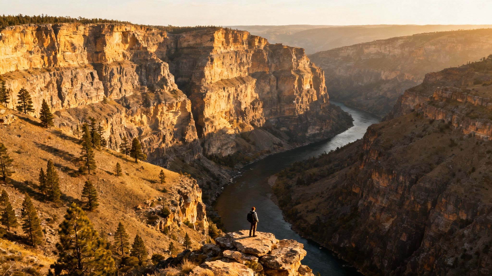
This trail’s main appeal is its raw, rugged beauty. The elevated cliff-top path delivers stunning, panoramic vistas of the Barron River flowing far below. While relatively short, the trail is a photographer’s dream and a perfect destination for a high-reward hike. It is an ideal highlight for a longer trip.
See also: weekend getaways from Ottawa.
Trail Details & Logistics
- Distance from Downtown Ottawa: Approximately 210 km (In Algonquin Provincial Park)
- Trail Length: 1.5 km loop
- Difficulty: Moderate. The trail includes steep climbs and rocky terrain. The cliff edges are unfenced.
- Estimated Time: 45-60 minutes
- Highlights: Towering cliff faces, panoramic views of the Barron River valley, dramatic geological formations, excellent photography opportunities.
- Parking & Transit: A dedicated parking lot is available at the trailhead. A valid Algonquin Park vehicle permit is required for entry.
- Map: View Trail on Google Maps
Know Before You Go
This trail is not recommended for those with a fear of heights, and children must be kept under close supervision. Sturdy footwear is essential. For the most dramatic photos, visit on a clear day. Remember to check seasonal access restrictions. The fall colours here are spectacular, making it a premier autumn hiking destination.
10. Confederation Park Trail Network
For an urban exploration through the capital’s most manicured green spaces, the Confederation Park Trail Network is an essential Ottawa experience. This network of paved pathways offers a park-based walk, connecting multiple landmark sites like Confederation Park, the National Arts Centre, and the Rideau Canal. It provides a perfect setting for a leisurely stroll.
The primary appeal is its blend of nature, art, and national history. Walkers can admire historic monuments, fountains, and beautiful gardens while enjoying views of Parliament Hill. Its connectivity allows for easy extensions along the Rideau Canal or towards Major's Hill Park, creating a customizable urban adventure.
Trail Details & Logistics
- Distance from Downtown Ottawa: 0 km (Located in the city centre)
- Trail Length: Varies; multiple loops available, typically 1-3 km
- Difficulty: Easy. Fully paved and flat, suitable for all fitness levels.
- Estimated Time: 30-60 minutes, depending on the route.
- Highlights: Rideau Canal views, National War Memorial, various sculptures and fountains, seasonal floral displays.
- Parking & Transit: No dedicated parking. Best to use paid public parking garages nearby. The network is highly accessible via all downtown OC Transpo and O-Train routes.
- Map: View Trail on Google Maps
Know Before You Go
This trail network is perfect for anyone looking to incorporate a scenic walk into their downtown visit. Because it’s a central hub for events like Winterlude, it's wise to check for any planned closures or activities. For a quieter experience, an early morning or weekday walk is recommended.
Top 10 Hiking Trails Near Ottawa Comparison
| Trail | Difficulty | Distance & Time | Highlights |
|---|---|---|---|
| Rideau Falls Trail | Easy | 1 km (20-30 min) | Urban waterfall views, accessible |
| Pink Lake Trail | Moderate | 2.3 km loop (45-60 min) | Unique turquoise lake, stairs |
| Meech Lake Loop | Intermediate | 20 km loop (5-7 hrs) | Lakeside views, beaches, challenging |
| Mer Bleue Bog | Easy | 1.9 km boardwalk (30-45 min) | Rare boreal ecosystem, accessible |
| Stony Swamp Trails | Easy-Moderate | 40+ km network | Excellent birdwatching, wetlands |
| Pink Mountain Trail | Moderate-Difficult | 5.4 km loop (2-3 hrs) | Panoramic views, steep climb |
| Kingsmere Lake Trail | Intermediate | 2.5 km loop (1-1.5 hrs) | Pristine lake for swimming |
| Dunrobin Wolf Trail | Easy-Moderate | 2.5 km loop (45-60 min) | Quiet woods, wildlife spotting |
| Barron Canyon Trail | Moderate | 1.5 km loop (45-60 min) | Dramatic canyon views, unfenced cliffs |
| Confederation Park | Easy | 1-3 km network (30-60 min) | Downtown parks, historic sites |
Why Our Local Paths Matter
Lacing up hiking boots in the National Capital Region is more than just exercise. It’s an invitation to explore the soul of our landscape. We’ve journeyed from the urban paths of Rideau Falls to the ancient ecosystem of the Mer Bleue Bog. We’ve climbed to the stunning lookouts of Gatineau Park and navigated the rugged Canadian Shield.
Each trail offers a unique narrative. The powerful rush of water at Rideau Falls speaks to Ottawa's industrial history, while the silent bog tells a story stretching back to the last ice age. This diversity is what makes the collection of the best hiking trails near Ottawa so remarkable. You can find an adventure for any mood, season, or skill level, often a short drive from the city centre.
These local paths are essential. In a fast-paced world, our trails offer a vital sanctuary for physical health and mental clarity. They are outdoor classrooms, living museums, and accessible recreational spaces for everyone.
Protecting and appreciating these trails is an investment in our community’s well-being. By exploring them thoughtfully, we ensure that the rich tapestry of forests, wetlands, and lookouts that define the National Capital Region remains vibrant for generations to come. The path is waiting.
Stay connected to the pulse of your city, from its best-kept natural secrets to its most important local stories. For more articles that help you explore, understand, and engage with your community, visit us at NCR Now.