
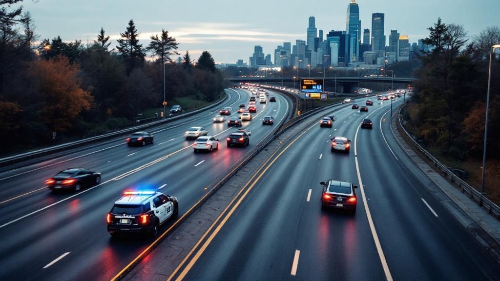
If you're asking "what happened on hwy 7 today," you need accurate, up-to-the-minute information. Here’s the critical update for your drive: a multi-vehicle collision is causing significant westbound delays near Carleton Place. The incident, which occurred during the morning commute, has led to lane closures and heavy congestion. Emergency services are at the scene, and drivers are strongly advised to seek alternate routes.
Today's Instant Hwy 7 Traffic Report
Driving on Highway 7 can be unpredictable, and nothing disrupts your day like an unexpected closure or major delay. This section is your go-to dashboard, designed to provide a clear, real-time summary of the traffic situation in the Ottawa and Eastern Ontario region. We deliver the essential, verified details you need right now, without the fluff.
Think of this as your first stop before you grab your keys. We monitor major incidents that could impact your route, giving you the information needed for smart, quick decisions. For a broader view of traffic across the city, you can always consult a detailed Ottawa traffic map to see how other routes are affected.
This quick snapshot helps you understand not just that there's a delay, but why it's happening, based on official reports.
Key Takeaway: Before you head out on Highway 7, always check for live incident reports. A quick glance at a summary table can save you from getting stuck in major delays by flagging active collisions, closures, and heavy congestion zones ahead of time.
To make it easy, we've compiled a live summary of today's key incidents. It gives you an at-a-glance overview of what’s happening, where, and what to expect based on the latest information from authorities.
Today's Live Incident Summary for Hwy 7 (Ottawa Region)
Here's a snapshot of the current and recent incidents impacting traffic on Highway 7 today. This table breaks down what's happening, its location, the impact on traffic flow, and the latest status from authorities.
| Incident Type | Location (Near) | Impact | Status |
|---|---|---|---|
| Multi-Vehicle Collision | Westbound at McNeely Ave | Major Delays, Lane Closed | Active |
| Disabled Vehicle | Eastbound at Hwy 15 | Minor Delays | Cleared |
| Road Debris | Westbound at Ashton Stn Rd | Caution Advised | Cleared |
| Police Activity | Eastbound near Perth | Slow Traffic | Ongoing |
This summary is updated as new information from official sources becomes available, so you can quickly assess the situation and adjust your travel plans.
Why Hwy 7 Is a Critical Ottawa Commuter Route
To understand the full impact of what happened on Hwy 7 today, you need to see the highway as more than just pavement. For thousands, it’s the primary artery connecting Ottawa to growing communities like Carleton Place, Perth, and beyond. It's a daily lifeline for commuters and commerce.
What makes Highway 7 so unique—and so vulnerable to disruption—is its dual nature. Part of it is a modern, multi-lane divided highway, while other sections remain a two-lane rural road. This contrast is a recipe for major traffic problems.
The Highway’s Dual Personality
On the wider, four-lane sections closer to Ottawa, a minor incident might only cause a temporary slowdown. But on the two-lane stretches, a single collision or stalled vehicle can bring traffic to a complete standstill. With no room to maneuver, backups can stretch for kilometres within minutes.
The points where the highway transitions from four lanes to two are natural bottlenecks. These zones require heightened driver awareness and are frequent locations for incidents, especially during peak hours or in poor weather conditions.
The highway's history also tells a story. It has expanded alongside the region for nearly a century. For instance, the highway was extended to connect with Perth between 1927 and 1932, cementing its role as a vital corridor. This history of piecemeal development explains its current design and why it remains so critical for local travel.
This infographic gives you a quick visual on how just a handful of incidents can throw a wrench in the works for daily drivers.
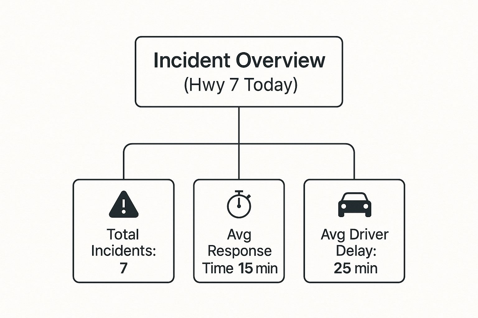
As you can see, it doesn't take much to create significant delays, which really drives home just how sensitive the highway is to any kind of disruption.
What Happened on Highway 7 Today? A Look at the Major Incidents
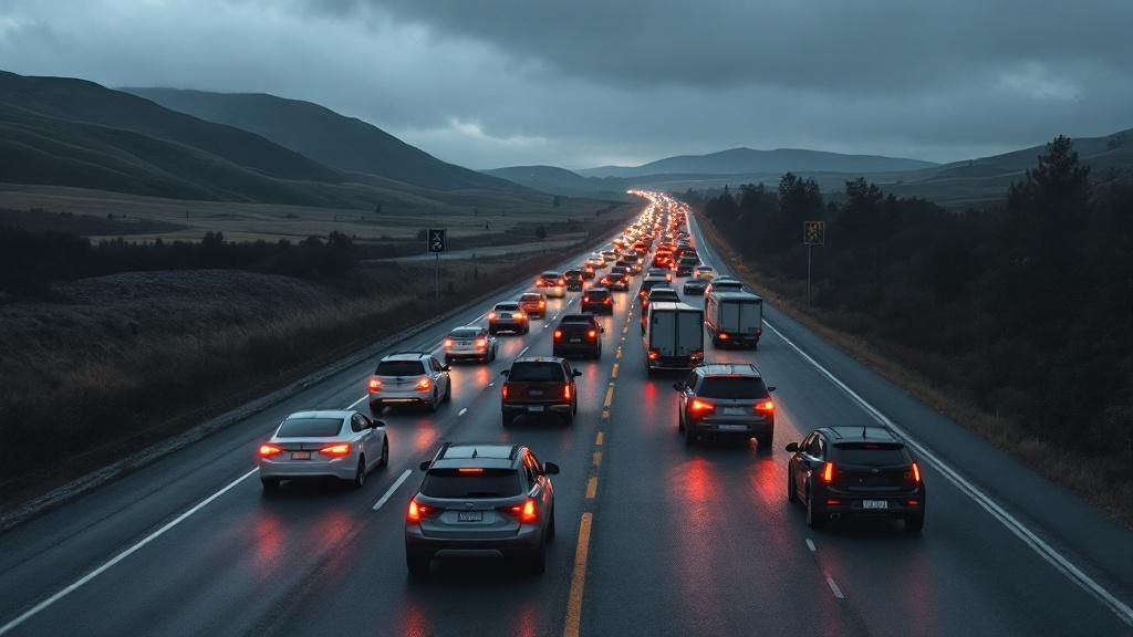
When you’re stuck in traffic asking, "what happened on Hwy 7 today," you want factual details, not generic alerts. Today’s major disruption stemmed from a significant collision that had a ripple effect across the region. Let's break down the events based on official reports.
The day's primary traffic event was a multi-vehicle crash during the morning rush hour. It occurred on the westbound side of Highway 7, in the critical stretch between McNeely Avenue and Dwyer Hill Road—a route thousands of commuters depend on.
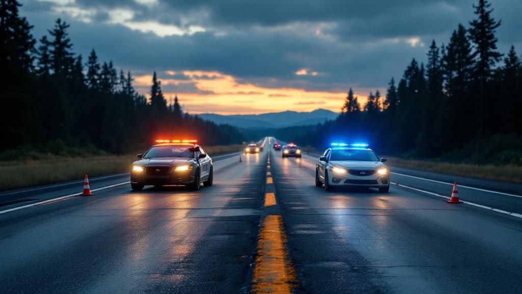
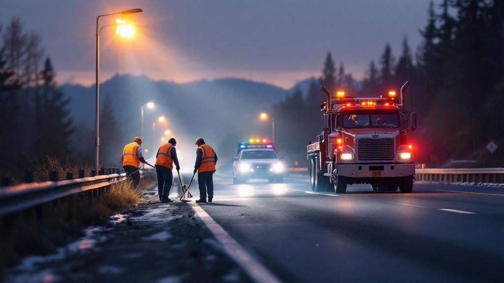
Initial reports from the scene confirmed a serious collision involving two passenger vehicles and a commercial transport truck. The incident was severe enough to require the complete closure of all westbound lanes, prompting the Ontario Provincial Police (OPP) to establish a full detour.
The Emergency Response and Why It Took So Long
As expected, emergency crews from the OPP and Ottawa Paramedic Service responded quickly. Their first priority is always to attend to anyone injured and secure the scene. While this immediate action is crucial, it also initiates what often becomes a lengthy closure for other motorists.
For drivers, an active police investigation means you’re not going anywhere soon. The focus shifts from clearing the road to gathering evidence. This can involve collision reconstruction teams who meticulously document the scene to determine the cause. It’s a slow, deliberate process that cannot be rushed, often taking several hours.
The impact on drivers was immediate. Traffic was diverted onto local feeder roads, which are not designed for highway-level volume and quickly became congested.
- Official Detour Route: Westbound traffic was directed off Highway 7 at the Dwyer Hill Road exit. From there, vehicles were routed onto regional roads to bypass the crash scene.
- The Gridlock: This diversion created a domino effect, leading to kilometres of stop-and-go traffic on smaller connecting roads. Commuters reported the detour added up to 45 minutes to their travel time.
- Reopening Timeline: The OPP's initial estimate suggested a late-morning reopening, but the complexity of the investigation and cleanup pushed the full reopening into the afternoon.
Incidents like this highlight the fragility of the Highway 7 corridor. A single major crash on a key section can sever a primary artery for the entire region, underscoring why access to verified, fact-based updates is essential for navigation.
Navigating Planned Construction and Roadwork
Not all traffic jams are unexpected. While sudden crashes cause significant disruption, many slowdowns are due to planned construction and road maintenance. Knowing about these scheduled projects can help you plan your drive and understand what's happening on Hwy 7 today.
These projects are essential for maintaining the highway's safety and integrity. The work can range from repaving and line painting to larger-scale projects like bridge rehabilitation or culvert replacement. Each project brings its own impacts, typically involving lane reductions, traffic shifts, or lower speed limits in work zones.
Current and Upcoming Work Zones
Knowing where active construction zones are is key to avoiding delays. Major infrastructure work requires extensive planning and permits, a complex process you can learn more about in our guide on building permits in Ottawa.
Here’s a summary of key spots to watch for based on Ministry of Transportation schedules:
- Paving Operations near Perth: Expect single-lane closures with pilot vehicles guiding traffic. This work is often scheduled for off-peak hours, but delays are still possible.
- Bridge Maintenance at Mississippi River: Crews are conducting structural inspections, which may lead to intermittent lane closures. Expect traffic to slow down when approaching this area.
- Long-Term Expansion Project: The twinning project east of Carleton Place remains a major work zone with adjusted traffic patterns and strictly enforced speed limits.
The constant need for roadwork highlights the engineering challenges of maintaining Ontario's highways. For example, a historical project on a similar roadway, Highway 7A, in the early 1960s addressed a road that was sinking into a marsh. Engineers excavated over 8.1 million cubic feet of unstable soil and replaced it with solid fill to create a stable roadbed—a testament to the complex work that keeps our highways functional.
This kind of proactive engineering ensures the highway remains safe and reliable for all users.
Finding the Best Alternate Routes and Detours
When an incident shuts down Highway 7, the immediate question is, "How do I get around this?" Knowing your options is essential. A reliable alternate route can be the difference between a minor inconvenience and a major delay, especially when you need to understand what happened on Hwy 7 today and how to avoid it.
The best detours typically involve regional and county roads that run parallel to the highway. While these smaller roads have lower speed limits and more intersections, they become vital when the main artery is blocked.
Key Alternate Routes and Their Trade-Offs
When considering a detour, you must weigh the pros and cons. A route that appears shorter on a map may take longer due to local traffic, road conditions, or numerous traffic signals.
- Regional Road 29 (Carleton Place Area): A common choice for bypassing incidents near Carleton Place. It’s a direct alternative but can become congested quickly when official detours are in effect.
- County Road 43 (Perth Area): A viable option for circumventing closures further west. The road is generally well-maintained but will add distance to your trip.
- Local Township Roads: These should be considered a last resort. They are often unpaved or poorly marked and are best used only with caution and local knowledge.
The complexity of detours is partly due to the highway’s administrative history. What seems like one road is a patchwork of sections managed by provincial and municipal governments. Between 1997 and 2007, approximately 63 kilometres of Highway 7 were "downloaded" to local municipalities, primarily closer to the GTA, which can affect maintenance and traffic management coordination.
If you'd rather avoid traffic altogether, consider turning a delay into an opportunity. Check our guide to events in Ottawa and find an alternative way to spend your time.
Your Questions About Driving Hwy 7, Answered
For regular commuters on Highway 7, sudden standstills are a familiar frustration. Having access to the right information can make all the difference.
Let’s address some of the most common questions from Hwy 7 drivers.
Where Can I Find Reliable, Live Traffic Info?
For a comprehensive view, it's best to consult multiple sources. Relying on a single source might not give you the complete, real-time picture.
Your first stop should be official channels. Ontario 511, the Ministry of Transportation’s traveller information service, is available via app and website, providing accurate data on closures, construction, and incidents.
Next, use navigation apps like Waze or Google Maps. They leverage real-time, crowdsourced data from other drivers and often report slowdowns before they are officially confirmed.
Finally, monitor local Ottawa news outlets and regional OPP social media accounts. During a major incident, they provide essential context explaining why a road is closed.
What does an "OPP Investigation" really mean for your commute? It signifies a serious incident. This is not a quick cleanup; it means the Ontario Provincial Police are conducting a full forensic analysis at the scene. You should expect the road to be closed for several hours and find an alternate route immediately.
What Are the Typical Rush Hour Times?
On weekdays, traffic patterns on Highway 7 near Ottawa are fairly predictable.
- Morning Commute: The heaviest traffic is eastbound (towards Ottawa) from approximately 6:30 AM to 9:00 AM. The section between Carleton Place and Ottawa is a known bottleneck.
- Evening Commute: Congestion builds westbound (away from Ottawa) starting around 3:30 PM and lasting until 6:30 PM.
- Weekend Travel: The "cottage country" effect is significant. Friday afternoons and Sunday evenings in the summer can see traffic volumes that rival weekday rush hours.
How Much Does Police Enforcement Actually Help?
Visible police presence is a key strategy for managing driver behaviour and enhancing safety. Its impact is most evident during targeted safety blitzes.
For example, a recent safety grant program on a similar Hwy 7 corridor resulted in over 3,700 traffic stops in a single year. Officers focused on high-risk behaviours like speeding, distracted driving, and seatbelt use, issuing 578 citations for wireless device use alone. This type of focused enforcement directly contributes to a safer road environment for everyone.
For the latest updates on what's happening in Ottawa and the National Capital Region, from traffic to local news and events, trust ncrnow. Visit us at https://ncrnow.ca to stay informed.