
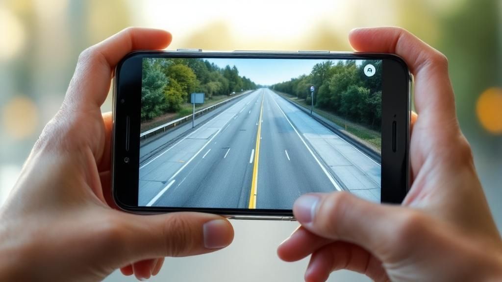
Ever been completely blindsided by a traffic jam that wasn't on your GPS? A live traffic camera feed is your secret weapon, giving you a real-time video stream of the road ahead so you can see congestion, accidents, or construction before you even leave the house. It's all about letting you proactively choose the best route and sidestep those frustrating, unexpected delays.
How Live Traffic Cameras Help You Beat Traffic
Think of a live traffic camera like a weather forecast, but for the pavement. Just as you’d check for rain before deciding on an outfit, a quick peek at a traffic feed gives you an instant, honest picture of the road conditions. That one simple check can be the difference between a smooth, breezy commute and getting stuck in soul-crushing gridlock.
While your GPS is great, it often lags behind what's happening right now. Live cameras, on the other hand, offer immediate visual proof. You can see for yourself how bad a slowdown really is, what's causing it, or if that jam from 20 minutes ago has finally cleared. This kind of visual intel is an absolute game-changer for any driver in the National Capital Region.
Plan Smarter, Not Harder
There’s nothing worse than rushing out the door only to hit a solid wall of red taillights. Live traffic camera feeds empower you to make smarter moves before you even grab your keys. A quick check of the routes in and around Ottawa gives you a massive advantage.
This pre-trip recon lets you:
- Identify Congestion Hotspots: See exactly where traffic is crawling on major arteries like the 417 or key roads.
- Spot Accidents or Hazards: A camera feed can show you flashing lights, debris on the road, or other unexpected snags in real-time.
- Verify Construction Zones: Confirm if those lane closures are actually causing a backup or if you can sail right through.
To give you a clearer picture, here’s a quick rundown of what these systems offer and how they directly benefit you on the road.
Live Traffic Camera Features at a Glance
| Feature | What It Does | How It Helps You |
|---|---|---|
| Real-Time Video | Streams live video from cameras at key intersections and highways. | See current traffic flow, not just an icon on a map. |
| Wide Coverage | Cameras are placed along major routes, bridges, and known chokepoints. | Get a comprehensive view of your entire potential route. |
| Incident Verification | Provides a direct look at accidents, breakdowns, or road closures. | Judge the severity of a delay and decide on an alternate route instantly. |
| Weather Conditions | Shows you actual road conditions like rain, snow, or ice. | Drive safer by knowing what to expect from the road surface. |
| 24/7 Accessibility | Feeds are available online anytime, on any device. | Plan your trip whether you're leaving at 7 a.m. or 10 p.m. |
This table shows it's not just about avoiding traffic; it's about gaining control over your entire journey.
A study of commuter habits revealed that drivers who checked real-time road conditions before leaving reported up to 30% less travel-related stress. Simply knowing what you're driving into removes the anxiety of the unknown and puts you back in the driver's seat—literally.
Ultimately, this technology shifts you from being a reactive driver—always getting caught off guard—to a proactive planner. You'll save time, burn less fuel idling in traffic, and make your daily travels a whole lot safer and more predictable.
Understanding How Traffic Cameras Work
Ever found yourself on a traffic app, checking your route, and wondered how that live video feed from a highway camera actually gets to your phone? It might seem like some kind of digital magic, but the technology behind it is surprisingly straightforward once you break it down.
It all begins with specialized cameras mounted strategically along major roads, at key intersections, and on bridges throughout the National Capital Region. These aren't your typical home security cameras. We're talking about rugged, all-weather CCTV (Closed-Circuit Television) cameras built to run 24/7. Their one job is to capture a constant video stream of what’s happening on the road, acting as the eyes of the entire traffic monitoring system.
This raw video data needs to get from the camera to a central hub, and it needs to get there fast. The video is transmitted almost instantly through a high-speed network, which in most modern cities is built on fibre optic cables. Think of it as a private superhighway for data, capable of carrying huge amounts of information with virtually no delay. This is what ensures the picture you see is as close to real-time as possible.
The Brains of the Operation
But the feed doesn't go directly from the camera to your screen. First, it travels to a central command hub, known as a Traffic Management Centre (TMC). This is the nerve centre for the whole operation. Inside, technicians and automated systems watch over hundreds of camera feeds from across the region, often on a massive wall of screens.
A Traffic Management Centre is essentially a mission control for our roads. Its purpose is to monitor traffic flow in real-time, spot problems like accidents or breakdowns, and coordinate a quick response to keep everyone moving as smoothly and safely as possible.
This centralized view is crucial. It allows authorities to see the bigger picture—they can spot a slowdown forming on the Queensway, confirm a reported accident on Hunt Club Road, or see how a big event at Lansdowne is impacting traffic, all from one place.
This infographic really simplifies the three-step journey from the roadside to your screen.
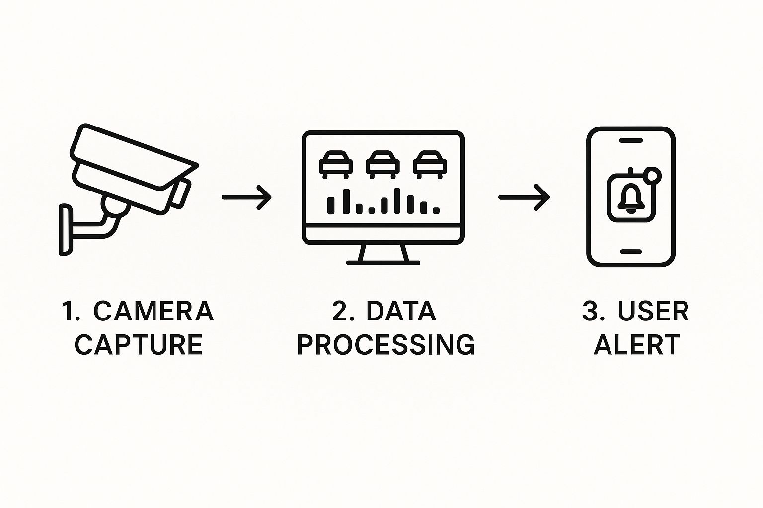
As you can see, the camera on the street captures what's happening. That footage is then sent to a central system to be processed and analyzed before being pushed out as an alert or a viewable feed right to your device. From there, the processed information is made available to the public.
From the Centre to Your Screen
So, how does that monitored feed finally reach you? The TMC makes the live video streams available to public-facing websites and apps. This includes official city resources, like the City of Ottawa's traffic camera map, and provincial systems. When you pull up a live traffic camera on your phone or computer, you're tapping directly into that broadcast.
The whole system is built for speed and reliability, so you can trust what you’re seeing to make smarter decisions about your commute. By understanding this simple flow—from camera capture to network transmission to central management—the technology becomes a lot less mysterious and a whole lot more useful in your daily life.
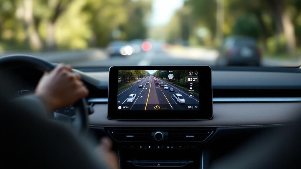
How to Access Ottawa and NCR Traffic Feeds
Alright, you get the theory behind how a camera on the side of the road sends an image to your screen. Now for the practical part: how do you actually find and use these feeds yourself?
For anyone driving in Ottawa and the National Capital Region (NCR), a few official sources give you a direct window into what’s happening on major routes. Checking a live traffic camera before you grab your keys is one of the smartest things a commuter can do.
Your Go-To Sources for Live Feeds
The first stop for city streets is the City of Ottawa itself. They manage an interactive traffic map that’s perfect for getting a quick snapshot of key intersections and arterial roads. It’s an excellent tool, letting you click on individual cameras to see regularly refreshed still images.
When you’re hitting the big highways like the 417 (the Queensway), your best bet is Ontario's Ministry of Transportation (MTO). They run a more advanced system that gives you a real-time look at traffic flow along these crucial corridors.
Here’s where to find the most reliable traffic feeds:
- City of Ottawa Traffic Map: This is your go-to for cameras on municipal roads. The map plots every camera, making it easy to check specific spots like Bronson Avenue, Hunt Club Road, or routes around downtown before you go.
- MTO COMPASS Cameras (Ontario 511): Absolutely essential for highway commuters. This system gives you live camera access along the 400-series highways, including the vital stretches of the 417 and 416 that cut through Ottawa.
This multi-source approach isn't unique to Ottawa; it's a global standard. Over in California, for example, the Department of Transportation (Caltrans) operates over a thousand live cameras to monitor its massive highway network. These feeds are critical tools for helping authorities and drivers see everything from a minor backup to a major accident in real-time.
A simple two-minute check before you leave the house can easily save you twenty minutes of gridlock frustration. Bookmark these official sources on your browser or phone to create your own personal traffic dashboard.
Getting the Most Out of Traffic Views
Using these tools effectively is about more than just peeking at one camera—it’s about piecing together a complete picture of your journey.
Before you head out, pull up the map and check cameras at several key points along your planned route. Look at the on-ramps you’ll use, the major intersections you need to cross, and the highway sections you’ll be driving on.
To get an even sharper perspective, check out our detailed Ottawa traffic map. It pulls together different data points to help you make truly informed decisions. It helps you see not just that there’s a jam, but why—whether it’s construction, an accident, or just the usual rush-hour squeeze. Combine these tools, and you can confidently pick the fastest and safest route, every single time.
The Growing Role of Cameras in Public Safety
Sure, checking a live traffic camera feed can help you dodge a morning jam on the 417, but these roadside eyes are doing a lot more than just saving you time. They’re quietly becoming one of the most important tools for building safer communities, moving beyond simple traffic monitoring to become active players in public safety.
Think of it this way: they used to just be passive observers. Now, they're providing crucial, objective evidence that helps law enforcement and city officials respond to incidents, understand traffic patterns, and tackle dangerous driving head-on.
A Modern Tool for Road Safety
One of the most talked-about uses for this tech is automated speed enforcement. It’s not about setting up random speed traps to catch people off guard. Instead, cities are using camera data to pinpoint high-risk areas—like school zones, community safety zones, and busy neighbourhood streets—and enforce speed limits where it matters most.
This data-driven approach means enforcement is consistent, fair, and focused on changing driver behaviour for the long haul.
According to the Insurance Institute for Highway Safety (IIHS), speed cameras can reduce injury crashes by up to 50% in some contexts. That’s a powerful testament to their ability to prevent accidents before they even happen.
Ultimately, the goal is deterrence, not just tickets. By making drivers more conscious of their speed in sensitive areas, these systems help foster a culture of safety for everyone on the road—pedestrians, cyclists, and other drivers alike. It's a prime example of how public services, much like mail delivery, are evolving to meet modern needs. Speaking of local services, if you're tracking other updates, you might find our guide on the Canada Post strike situation helpful.
A Real-World Safety Initiative
Cities are already putting this into practice with impressive results. Take San Francisco, which began its automated speed enforcement pilot program in early 2024. Backed by new state law (AB 645), the city began installing cameras in high-injury network zones. After an initial warning period, the system will begin issuing real tickets, a major move toward using live camera tech for direct safety enforcement. You can dive deeper into this initiative on the SFMTA blog.
This shows just how a live traffic camera network can be repurposed for the greater good. The information gathered helps officials make smart, evidence-based decisions, showing them exactly where safety interventions will have the biggest impact. By identifying speeding hotspots, cities can deploy their resources more effectively, turning simple traffic monitoring into a robust public safety program that protects every resident.
Using Traffic Data to Build Smarter Cities
The constant stream of images from a live traffic camera network does more than just help you sidestep a morning traffic jam. It's an absolute goldmine of data for the urban planners and engineers tasked with shaping our city's future. By analyzing this wealth of visual information, cities can finally move beyond guesswork and start making smart, evidence-based decisions about our roads and infrastructure.
Think of this data as a diagnostic tool for the city's circulatory system. It reveals the natural pulse of traffic—how it ebbs and flows throughout the day, where chronic blockages form, and which intersections are hotbeds for accidents. This kind of insight is the bedrock of effective, long-term urban planning.
From Data Points to Safer Streets
For years, trying to solve traffic problems felt like putting together a puzzle with half the pieces missing. Planners often had to rely on historical data and limited observations. Now, traffic data provides those missing pieces, painting a clear, real-time picture of how drivers actually behave on our roads.
This information is crucial for justifying and designing critical infrastructure upgrades, such as:
- Adding a new turning lane at a notoriously backed-up intersection.
- Retiming traffic signals to sync up with peak-hour flow.
- Redesigning road layouts to minimize conflicts between cars, cyclists, and pedestrians.
Traffic data turns abstract problems into solvable equations. It allows engineers to pinpoint a specific bottleneck and model the impact of a proposed change, ensuring public funds are invested where they will make the most difference.
This proactive approach is particularly powerful for improving safety. Data from automated speed enforcement cameras, for instance, tells us exactly where dangerous driving is most common. In a recent analysis of camera data, San Francisco revealed that speeding is a deeply rooted issue. Even during the initial 60-day warning-only period, thousands of warnings were being issued daily for significant speeding in designated zones. You can dive deeper into these findings in CalBike's analysis.
Building a More Efficient City
Ultimately, all this data helps build a more efficient and liveable city for every single one of us. Better traffic flow means less time stuck in a car, which translates to lower fuel consumption and reduced emissions.
It’s not just about the daily commute, either. This data is invaluable for planning around major public gatherings, from parades to concerts. By understanding how large crowds will affect traffic patterns, organizers can create smarter plans for getting people in and out smoothly. If you're heading to a local festival, our guide to events in Ottawa can help you get prepared.
By using traffic data intelligently, cities ensure that our roads serve the community effectively, adapting to its changing needs and making urban life that much smoother and safer.
The Future of AI in Traffic Management
The live traffic cameras we rely on today give us a real-time window into our city’s streets, but frankly, this is just the beginning. The next major leap in managing how Ottawa moves involves integrating Artificial Intelligence (AI) and machine learning. This isn't some far-off sci-fi concept; it's the next logical step in turning our passive camera feeds into an active, intelligent network that works for us.
Think about a system that doesn't just show you a traffic jam but actually predicts it before it even starts. By analyzing tiny shifts in traffic flow, vehicle speed, and density across hundreds of cameras at once, AI can spot the early warning signs of congestion. This opens the door to proactive fixes, like adjusting traffic light timing on the fly or sending alternate route suggestions to drivers before a small bottleneck spirals into city-wide gridlock.
Predictive Power and Instant Response
AI's real power comes from its ability to see patterns a human operator could never catch. An AI-driven traffic system does more than just count cars; it can understand the makeup of traffic in real-time.
For example, it could flag an unusual number of heavy trucks on a route not built for them or instantly spot a vehicle driving erratically. This leads to some game-changing capabilities:
- Automated Incident Detection: AI algorithms can be trained to recognize the visual chaos of an accident—like stopped cars in a live lane or a flurry of sudden braking. The system could then automatically ping emergency services with the exact location and a live video feed, shaving precious minutes off response times.
- Dynamic Rerouting: Instead of every driver’s GPS reacting to a crash after the fact, a central AI could orchestrate traffic flow across the entire grid. It could intelligently reroute vehicles onto less congested roads in a coordinated ballet, preventing the secondary jams that always seem to follow a major incident.
The goal here is to flip the script from a reactive model to a predictive one. It's about solving traffic problems before they ruin the commute for thousands of people, creating a safer and more fluid transportation network for everyone.
This future isn’t as distant as you might think. As AI technology matures, the simple live traffic camera will evolve from a passive observer into the eyes of a city-wide brain—one dedicated to keeping traffic moving smoothly, safely, and efficiently.
Your Traffic Camera Questions, Answered
So, you’ve seen how live traffic cameras can be a commuter’s best friend. But with all this tech watching over our roads, it's totally normal to have a few questions pop up, especially around things like privacy. Let’s cut through the noise and get you some straight answers.
The big one we hear all the time is about privacy: are these cameras recording my every move? For the most part, the answer is no. The main job of a traffic monitoring camera is to give officials a live, real-time look at what’s happening on the roads. They aren't designed to store footage for long periods, if at all. Think of them less like a security camera creating an archive and more like a live window showing you what's happening right now.
That brings us to what happens with all that visual info. City officials use these feeds to keep an eye on road conditions, quickly spot accidents, and figure out which intersections or stretches of road are crying out for an upgrade. This data is gold for making smart, evidence-based decisions that ultimately make our drives safer and a little less frustrating.
How Accurate Are the Feeds, Anyway?
When you pull up a live traffic camera feed, you’re seeing what’s happening on the road with only a few seconds of delay. This makes it an incredibly reliable tool, often more up-to-the-minute than a GPS app that might be using slightly older data to estimate your travel time.
It’s also crucial to know what you’re looking at. Not every camera perched on a pole has the same job:
- Traffic Monitoring Cameras: These are the public-facing cameras we've been talking about. Their sole purpose is to observe traffic flow and help everyone get a clear picture of road conditions.
- Red Light Cameras: These are strictly for enforcement. They're programmed to snap a picture of vehicles that blow through a red light.
- Speed Enforcement Cameras: You'll find these in specific safety zones, where they're used to ticket drivers who are going over the speed limit.
While traffic camera footage can be a huge help in sorting out what happened during a crash, getting your hands on it isn't always simple. Retention policies vary wildly between agencies, and in many cases, the footage you need might not have been saved at all.
Knowing the difference helps build trust in the system. Live traffic cameras are there to be a helpful public resource, giving you the visual proof you need to plan a smarter, safer, and less stressful commute.
For the latest news and insights on what's happening in Ottawa and the National Capital Region, stay informed with ncrnow. Visit us at https://ncrnow.ca.